

Sekarang Anda mengikuti
Kesalahan mengikuti pengguna.
Pengguna ini tidak mengizinkan pengguna mengikuti dia.
Anda sudah mengikuti pengguna ini.
Paket keanggotaan Anda hanya boleh punya 0 follow. Tingkatkan di sini.
Berhasil berhenti mengikuti
Kesalahan mengikuti pengguna.
Anda telah berhasil merekomendasikan
Kesalahan merekomendasikan pengguna.
Ada sesuatu yang salah. Silakan muat ulang halaman dan coba lagi.
Email berhasil diverifikasi.

lahore,
pakistan
Saat ini 7:18 PM di sini
Bergabung Juli 13, 2017
0 Rekomendasi
Muneeb A.
@MUNEEBAAMIR
0,0
0,0
0%
0%
lahore,
pakistan
N/A
Pekerjaan Selesai
N/A
Sesuai Anggaran
N/A
Tepat Waktu
N/A
Tingkat Rekrut Ulang
Geospatial Expert
Hubungi Muneeb A. mengenai pekerjaan Anda
Login untuk mendiskusikan hal-hal detail melalui kotak obrolan.
Portofolio
Portofolio


Preparation of Digital Elevation Model
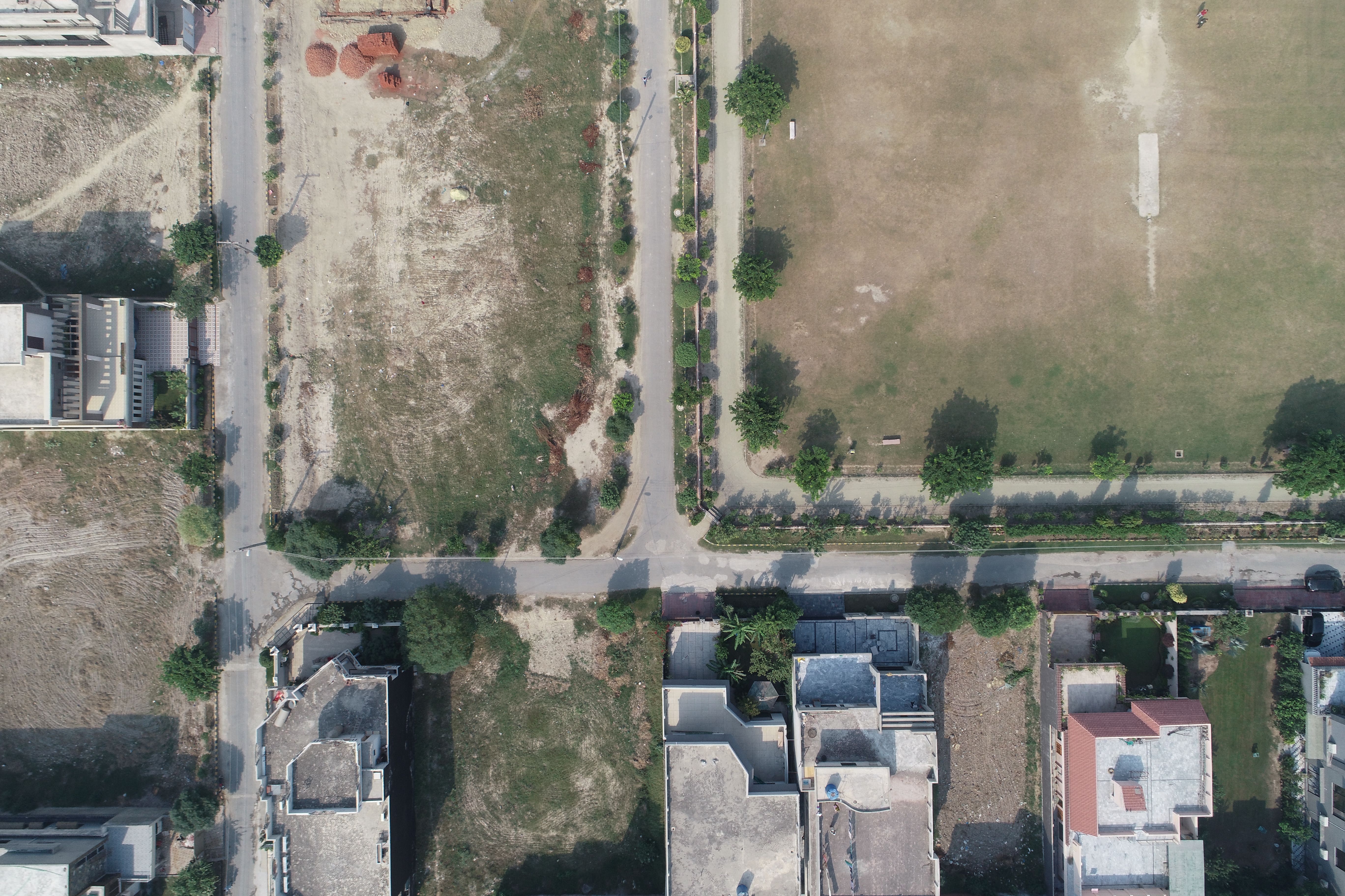

Drone Mapping

Drone Mapping

Drone Mapping
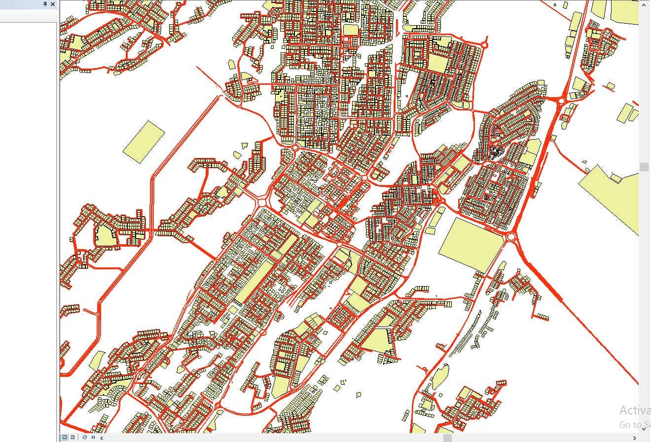

CAD to SHP Files

CAD to SHP Files
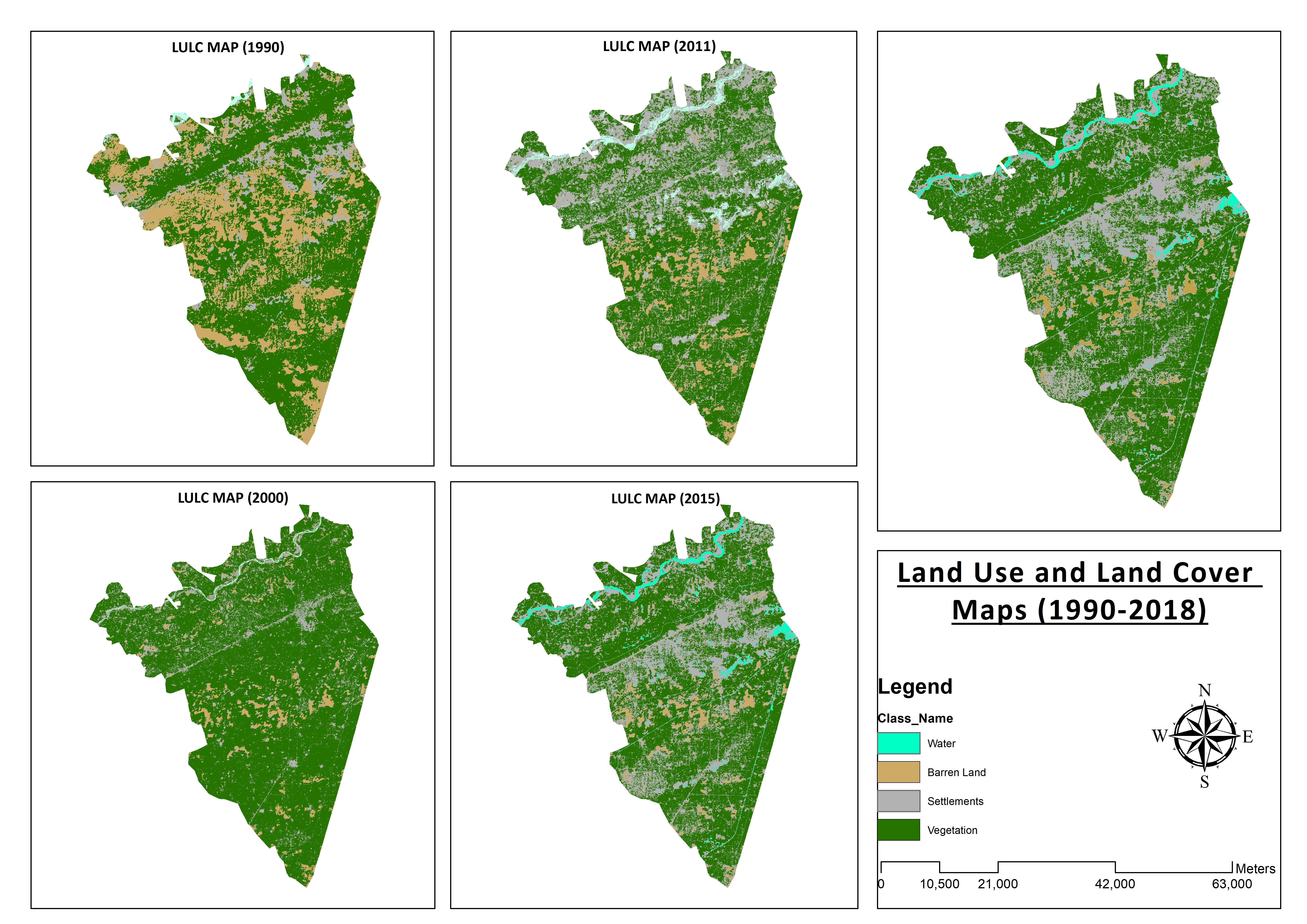

Land Use and Land Cover Maps
Preparation of Digital Elevation Model
Drone Mapping
Drone Mapping
Drone Mapping
CAD to SHP Files
CAD to SHP Files
Land Use and Land Cover Maps
Ulasan
Perubahan tersimpan
Tidak ada ulasan terlihat di sini!
Pengalaman
Remote Sensing and GIS Analyst
Sep 2018 - Okt 2019 (1 tahun, 1 bulan)
Developed, integrated and Implemented GIS and Geodesy based Topographic Survey Plans under different Hydro-Power Projects in Northern Pakistan, Extension of Canal Projects to increase its capacity in Sindh-Balochistan, Analysis of Suitable Site Selection for different development sites by using Drone for Aerial Mapping and their detailed pre-feasibility studies with different softwares, to analyse and interpret spatial data to produce interacting Maps and Reports while ensuring quality control.
Research Associate GIS
Okt 2015 - Okt 2018 (3 tahun)
Deployed GIS-based system under Urban Immovable Property Tax (UIPT) for Punjab Excise & Taxation Department. Provided comprehensive support in creating the system while take advantage of software suites like ArcGIS Suite and ERDAS Imagine. Prepared communicating maps to help surveyors in Analyzing geo-spatial data to verify it during ground truthing. Created shapefiles to merge topographical data with external data through layering process.
Edukasi
Master of Philosophy in Geographic Information System
(2 tahun)
Bachelors in Geographic Information System
(4 tahun)
Kualifikasi
MS-Office
TEVTA
2017
MS-Office Certification in MS-Word, Excel and Power Point.
Publikasi
Analysis of Flood Damage Assessment through Different Satellite Datasets in Southern Punjab,Pakistan
International Journal of Innovations in Science & Technology
RS and GIS techniques can achieve the objectives and significant analyses through visual interpretations. These techniques are also used to identify the flood affected regions. The study site was examined by applying supervised classification determining that 16900.96 Hectors of agriculture land was damaged while Sparse Riverine Forest had the area 44.52 hectors. The damaged built-up area was 1805.78 Hectors.
Estimation of Net Rice Production by Remote Sensing and Multi Source Datasets
Sarhad Journal Of Agriculture
Estimation of net crop production before harvest enables agronomists and decision makers to determine the volume of grain precisely. Yield estimation is one of the challenging tasks which is significant to evaluate accurately for farmers. This research was conducted in eastern Punjab Pakistan by incorporating yield/area as reported by Crop Reporting Service Department along with open source satellite datasets.
Hubungi Muneeb A. mengenai pekerjaan Anda
Login untuk mendiskusikan hal-hal detail melalui kotak obrolan.
Verifikasi
Keahlian Teratas
Telusuri Freelancer Serupa
Telusuri Etalase Serupa
Undangan berhasil dikirim!
Terima kasih! Kami telah mengirim Anda email untuk mengklaim kredit gratis Anda.
Anda sesuatu yang salah saat mengirimkan Anda email. Silakan coba lagi.
Gagal menyalin ke clipboard, silakan coba lagi setelah mengubah izin Anda.
Salin ke clipboard.
Memuat pratinjau
Izin diberikan untuk Geolokasi.
Sesi login Anda telah kedaluwarsa dan Anda sudah keluar. Silakan login kembali.