

Sekarang Anda mengikuti
Kesalahan mengikuti pengguna.
Pengguna ini tidak mengizinkan pengguna mengikuti dia.
Anda sudah mengikuti pengguna ini.
Paket keanggotaan Anda hanya boleh punya 0 follow. Tingkatkan di sini.
Berhasil berhenti mengikuti
Kesalahan mengikuti pengguna.
Anda telah berhasil merekomendasikan
Kesalahan merekomendasikan pengguna.
Ada sesuatu yang salah. Silakan muat ulang halaman dan coba lagi.
Email berhasil diverifikasi.

pancevo,
serbia
Saat ini 8:09 AM di sini
Bergabung April 30, 2007
2
Rekomendasi
Darko J.
@ReflectColor
6,4
6,4
91%
91%
pancevo,
serbia
96%
Pekerjaan Selesai
100%
Sesuai Anggaran
100%
Tepat Waktu
19%
Tingkat Rekrut Ulang
Code Development | Google Maps | GIS
Hubungi Darko J. mengenai pekerjaan Anda
Login untuk mendiskusikan hal-hal detail melalui kotak obrolan.
Portofolio
Portofolio


Google Maps & Fusion Tables

Google Maps & Fusion Tables
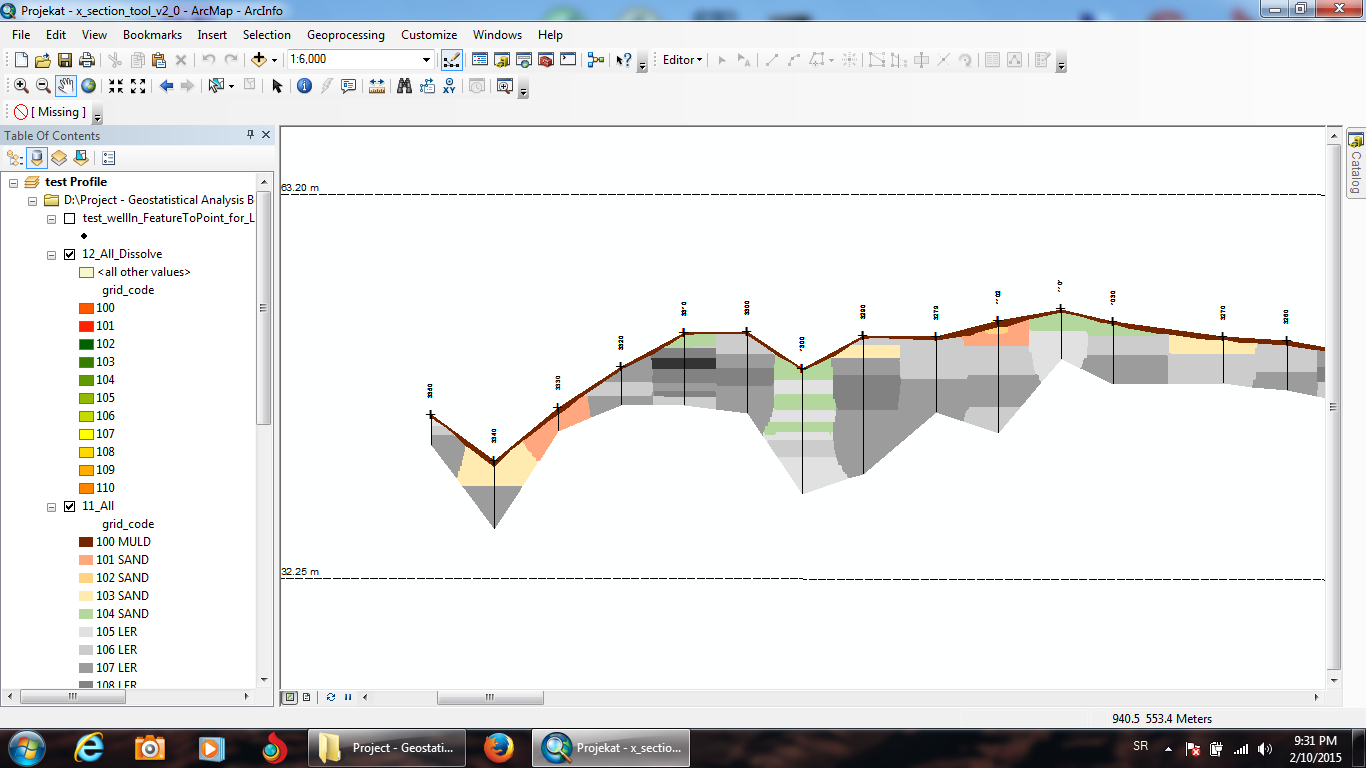

GIS (ESRI ArcGIS and ArcScene software)
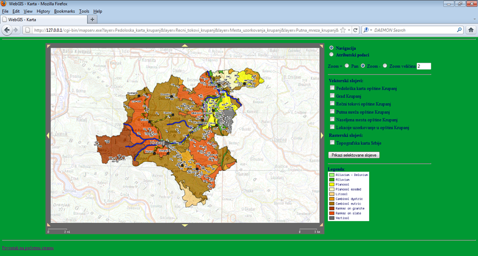

MapServer & PostgreSQL/PostGIS & MS SQL server
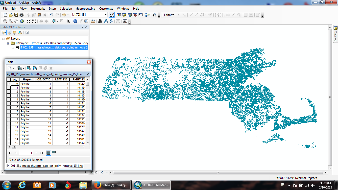

Remote Sensing & PostgreSQL/PostGIS & Google Maps
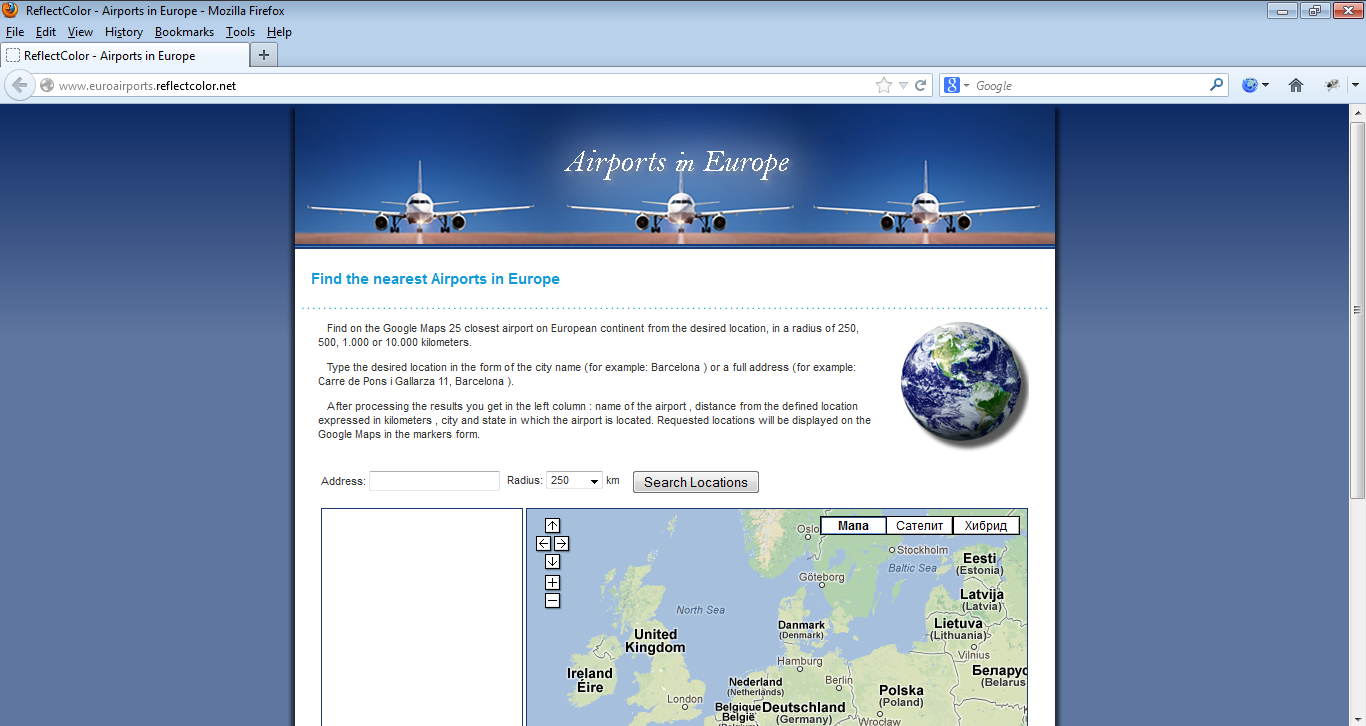

Google Maps & PHP & MySQL
Google Maps & Fusion Tables
Google Maps & Fusion Tables
GIS (ESRI ArcGIS and ArcScene software)
MapServer & PostgreSQL/PostGIS & MS SQL server
Remote Sensing & PostgreSQL/PostGIS & Google Maps
Google Maps & PHP & MySQL
Ulasan
Perubahan tersimpan
Menampilkan 1 - 5 dari 38 ulasan
$120,00 USD
Cartography & Maps
Geolocation
GPS
Geospatial
B

•
$578,91 USD
PHP
Cartography & Maps
MySQL
Geolocation
+1 lagi
G

•
$100,00 USD
PHP
Cartography & Maps
MySQL
Geolocation
+1 lagi

•
$400,00 USD
Python
Software Architecture
Cartography & Maps
NoSQL Couch & Mongo
Geospatial
•
$326,41 USD
Cartography & Maps
Geospatial
ASP.NET
Microsoft SQL Server
Google Maps API
S
•
Edukasi
M.Sc. Information Systems and Technologys (Faculty of Organizational Sciences)
(2 tahun)
Kualifikasi
Master's degree in Information Systems and Technology
Faculty of Organizational Sciences, University of Belgrade
2011
Publikasi
Application of USLE, GIS, and Remote Sensing in the Assessment of Soil Erosion Rates in Southeastern Serbia
Polish Journal of Environmental Studies
The assessment of soil erosion rate and its spatial distribution in the hilly-mountainous Nisava River basin was conducted by Universal Soil Loss Equation (USLE) model through a GIS-based approach. A Landsat 7 Enhanced Thematic Mapper (ETM+) image and normalized difference vegetation index (NDVI) were used for the determination of crop management factor. The average annual soil loss was estimated at 13.1 t·ha-1·yr-1, classifying the Nisava River basin under the high erosion rate category. Abou
Spatial modelling of soil erosion potential in a mountainous watershed of South-eastern Serbia
Springer
This work aims at the assessment of soil erosion rate and its spatial distribution in hilly mountainous Nisava River Basin (South-eastern Serbia) with a surface area of approximately 2,848 km2. The study was conducted using Universal Soil Loss Equation (USLE) model due to its modest data demand and easy comprehensible structure. The erosion factors of USLE were collected and processed through a GIS-based approach. Landsat 7 Enhanced Thematic Mapper (ETM+) image and normalized difference vegetation index (ND
Hubungi Darko J. mengenai pekerjaan Anda
Login untuk mendiskusikan hal-hal detail melalui kotak obrolan.
Verifikasi
Sertifikasi
Keahlian Teratas
Telusuri Freelancer Serupa
Telusuri Etalase Serupa
Undangan berhasil dikirim!
Terima kasih! Kami telah mengirim Anda email untuk mengklaim kredit gratis Anda.
Anda sesuatu yang salah saat mengirimkan Anda email. Silakan coba lagi.
Gagal menyalin ke clipboard, silakan coba lagi setelah mengubah izin Anda.
Salin ke clipboard.
Memuat pratinjau
Izin diberikan untuk Geolokasi.
Sesi login Anda telah kedaluwarsa dan Anda sudah keluar. Silakan login kembali.